
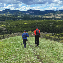
While the mountain parks get crowded and busy through the summer, solitude is almost guaranteed if you head south of Calgary following Highway 22 (the Cowboy Trail) past the small towns and villages of Bragg Creek, Diamond Valley, and Longview.
You’ll find many quiet campgrounds along the route as well – several that are even first-come, first-served, in case you dropped the ball on reservations or didn’t want to commit months in advance.
The following day trips all follow the Cowboy Trail south from Calgary, with extensions into Kananaskis for hiking, camping, or picnicking.
Day Trip 1: Bragg Creek with extension along Highway 66 into the Elbow Valley
Stop in Bragg Creek to visit the Frontier Candy & Ice-Cream shop. Take a stroll around the village and make sure to stop at one of the coffee shops. I love the pizza and baked goods at the Bragg Creek Bakery. Mabel and Marie’s is another great family-run bakery we like to support, and you can’t go wrong with the Heart of
Bragg Creek for healthy vegetarian and gluten-free menu features.
From Bragg Creek, head west on Highway 66 for a scenic drive into the Elbow Valley of Kananaskis.
Recommended day-use areas and trails:
Camping: First-come, first-served camping can be found at the Beaver Flats Campground.
Day Trip 2: Diamond Valley with extension along Highway 546 into the Sheep River Valley
Continuing south to Diamond Valley, the Chuckwagon Cafe is a well-known stop along the Cowboy Trail, with classic diner favorites for breakfast and lunch, open until 3:30pm on weekends.
Alternately, I recommend stopping in at the Eau Claire Craft Distillery to sample their locally produced spirits. They also serve great food on a family-friendly patio with mocktail options for the kids.
From Diamond Valley, head west on Highway 546 into the Sheep River Valley of Kananaskis.
Recommended day-use areas and trails:
Camping: First-come, first-served camping can be found at the Bluerock Campground at the end of the paved highway.
Day Trip 3: Longview with extension along Highway 541 to Highwood Junction
If you continue driving further south on Highway 22, no trip would be complete without stopping at the Longview Jerky shop. We also like visiting the Sugar Shack for ice cream.
From Longview head west on Highway 541 toward Highwood Junction, where you’ll meet Highway 40 from the south. If you continue driving along Highway 40, you can enjoy a lovely scenic drive over Highwood Pass towards the Kananaskis Lakes. Return to the city by driving past Kananaskis Village to reach the TransCanada Highway. Check a map before you plan your route and make sure you top up with gas if you need in Longview or at Highwood Junction.
Recommended day-use areas and trails:
If continuing to Highwood Pass, stop at the pass and hike the short Ptarmigan Cirque Trail into the alpine (4.5km return distance with 200m of elevation gain).
Camping: First-come, first-served camping can be found at the Greenford Campground. Other campgrounds that take reservations, but tend to have last-minute availability, are the Cataract Creek Campground and the Etherington Creek Campground near Highwood Junction. Reservations can be made on the Alberta Parks website.
Safety Notes and Reminders for Exploring the Cowboy Trail and South Kananaskis
Don’t forget to purchase a Kananaskis Conservation Pass when you go. It is required to park at all trailheads. You can also purchase an annual pass. Purchase either a day pass or annual pass at the Shop Alberta Parks website (the same one where you book campsites).
Other Considerations to Keep in Mind:
My family has fallen in love with the Elbow Valley, the Sheep River Valley, and the South Highwood area of Kananaskis. We spend most of our summer hiking and exploring these areas. Thanks to the ring road, these destinations are very accessible from north Calgary, too. Go exploring off the beaten path this summer and discover the quiet side of Kananaskis.
Tanya is a mother and a passionate enthusiast of all things outdoors including camping, hiking, stand-up paddleboarding, mountain biking, and skiing with her family and friends. She is the author of the blog "Family Adventures in the Canadian Rockies" at rockiesfamilyadventures.com and is very active on social media at MountainMomYYC.
See our related articles:







Calgary’s Child Magazine © 2026 Calgary’s Child